Reading a Fish Finder on Maine Lakes
There's nothing quite like the boundless beauty of Maine's lakes, but their vastness can also be incredibly daunting when you're trying to find fish. It’s a common frustration to spend hours drifting, casting into seemingly perfect water, only to come up empty-handed because you simply can't see what's happening beneath the surface. This comprehensive guide will pull back the curtain on using and interpreting a fish finder, transforming your guesswork into confident, strategic angling on Maine's diverse waters.
Why a Fish Finder is an Essential Tool on Maine Lakes
When you're out on a sprawling body of water like Moosehead Lake or Sebago Lake, it can feel like you're searching for a needle in a haystack. The sheer size and depth of these incredible Maine lakes mean that traditional shore-based observations or even just looking for surface activity often won't cut it. A fish finder isn't just a gadget; it's your underwater eyesight, revealing the hidden world below and drastically increasing your chances of success. It removes so much of the frustrating guesswork, allowing you to spend more time fishing in productive areas and less time wondering if there's even anything down there.
The Mystery of Deep Water and Maine's Vast Lakes
Imagine cruising across the seemingly endless expanse of a lake like Moosehead, with depths plummeting hundreds of feet. How on earth do you even begin to locate a school of hungry landlocked salmon or a solitary, deep-dwelling togue? Without a fish finder, you're essentially blind, relying on luck or perhaps old fishing tales, which don't always translate into actual fish in the cooler. The profound mystery of what lies in the dark depths can be a huge deterrent for anglers, leading to wasted time and effort. A reliable fish finder demystifies this process, offering a clear picture of the water column from top to bottom.
This technology allows you to pinpoint specific depths where fish might be holding, especially during different times of the year when temperature and oxygen levels drive fish deeper or shallower. It helps you understand the habitat much better than just guessing. For instance, if you're trying to find those elusive Landlocked Salmon Fishing in Maine, they often suspend at certain depths, away from the bottom. A fish finder is invaluable for identifying these mid-water targets, which would be practically invisible to the naked eye. It transforms fishing from a random cast-and-hope endeavor into a more precise, scientific pursuit, making your time on the water more productive and enjoyable.
Overcoming Maine's Varied Lake Bottoms and Structures
Maine's lakes are not just deep; they're incredibly complex. Beneath the surface, you'll find everything from smooth, silty flats to jagged rock piles, sunken timber, old roadbeds, and dramatic drop-offs. Each of these structures can hold different species of fish, and knowing what kind of bottom you're over is crucial for presenting the right lure or bait. It’s incredibly frustrating to fish a soft bottom with a jig designed for rocky structure, or to miss a perfect submerged weed line because you didn't know it was there. This diverse underwater topography can be a real challenge to navigate without the right tools.
A good fish finder maps out this underwater terrain with impressive detail, showing you contour changes, hardness of the bottom, and even individual pieces of structure like rocks or trees. This information is vital for anglers targeting species such as Smallmouth Bass Fishing in Maine, which often relate closely to rocky points, humps, or submerged timber. By identifying these "fishy" structures, you can position your boat precisely, cast accurately, and use techniques that are appropriate for the specific environment. It saves you from casting blindly over barren expanses and instead directs your efforts to high-percentage areas, making your day on the water far more effective.
Understanding the Basics: How Your Fish Finder Sees
Before you can interpret the squiggles and arches on your screen, it's really helpful to understand how your fish finder actually works. It's not magic, but rather a clever application of sound waves. Knowing the fundamental principles will give you a much better grasp of what you're seeing and help you adjust settings to get the clearest picture possible, especially in Maine's varied waters. Think of it as learning the language your fish finder speaks, allowing you to have a much more productive conversation with the underwater world.
Sonar Principles: Pings and Echoes
At its heart, a fish finder uses sonar technology, which stands for SOund NAvigation and Ranging. It's a bit like shouting into a cave and listening for the echo to figure out how far away the walls are. Your fish finder's transducer sends out rapid pulses, or "pings," of sound waves into the water column. These sound waves travel until they hit something – be it a fish, the bottom, or a submerged structure – and then they bounce back as "echoes" to the transducer. The unit then calculates the distance to the object based on how long it took for the echo to return and the known speed of sound in water.
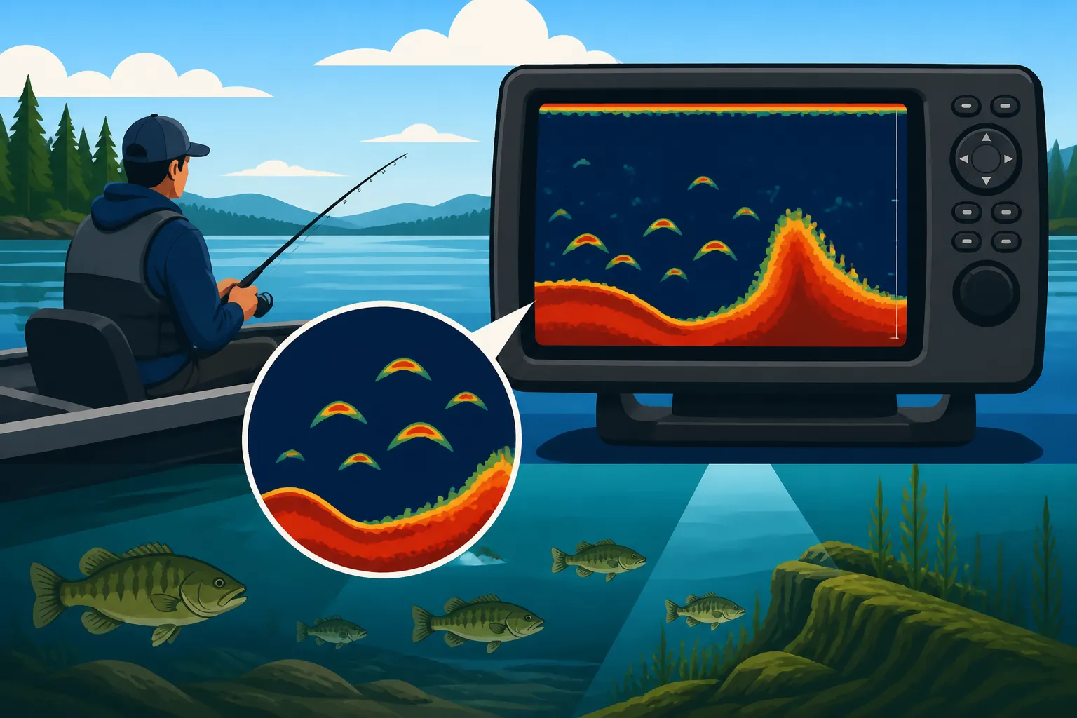
This information is then translated into the visual display you see on your screen. The screen scrolls from right to left, representing time, and objects closer to the top of the screen are shallower, while those closer to the bottom are deeper. The strength of the return signal also tells the unit about the size and density of the object. A strong echo often means a larger or harder object, like a big fish or a rocky bottom, while a weaker echo might indicate smaller fish or soft mud. Understanding this basic ping-and-echo process is foundational to accurately interpreting what your fish finder is showing you, whether you're scanning for Lake Trout and Togue Fishing in Maine in deep basins or shallower species near structure.
Transducer Placement and Beam Angle
The transducer is the unsung hero of your fish finder system, responsible for sending and receiving those vital sonar signals. Its placement is absolutely critical for optimal performance. If it's not mounted correctly – too high, too low, or at the wrong angle – you'll get inaccurate readings, interference, or lose the bottom altogether. Most transducers are mounted on the transom of the boat, but through-hull or trolling motor mounts are also common, each with its own advantages depending on your boat type and fishing style. A properly installed transducer ensures a clear "view" of the water directly beneath your boat, minimizing turbulence and air bubbles that can distort the signal.
Beyond placement, the transducer's beam angle is a key factor. Imagine a flashlight: a narrow beam illuminates a small, focused area, while a wide beam covers a larger area. Sonar beams work similarly. A wider beam (e.g., 60 degrees) is great for searching large areas quickly and finding fish in shallower water, but it loses detail in deeper water. A narrower beam (e.g., 20 degrees) provides much greater detail and penetration in deep water, making it excellent for pinpointing specific fish or structures, but it covers a smaller area. Many modern fish finders, even those you might find on Amazon, offer multiple beam angles or even chirp sonar, which sweeps through a range of frequencies for incredibly clear, detailed images. Choosing the right beam angle for the depth and target species on a particular Maine lake can make a huge difference in your success.
Decoding the Display: What Those Arches and Lines Mean
Once your fish finder is properly installed and powered up, you'll start to see a dynamic, constantly changing picture of the underwater world. But what do all those colors, lines, and shapes truly represent? Learning to distinguish between a genuine fish and a piece of submerged debris, or understanding the difference between a hard and soft bottom, is where the real skill comes in. This is the art of translating sonar signals into actionable fishing intelligence.
Identifying Fish Arches vs. Structure
The classic "fish arch" is what every angler hopes to see on their screen. An arch appears when a fish passes through the sonar beam, creating a curved signal as it enters, is directly beneath, and then exits the beam. A strong, well-defined arch typically indicates a larger fish, while smaller, broken arches or short lines usually represent smaller fish or schools of baitfish. However, it's not always a perfect arch. If your boat is stationary, a fish might appear as a vertical line or blob as it simply swims in place beneath the transducer. Speed also affects how arches appear: a fast-moving boat over a stationary fish will create a long, stretched-out arch, while a slow troll might create a shorter, fatter one.
The crucial part is learning to differentiate these fish signals from other underwater features. Submerged logs, rock piles, or dense weed beds can sometimes create shapes that might look like fish to the untrained eye. Structure often appears as more continuous, irregular shapes that don't have the distinct, isolated arch characteristic of a fish. For example, a rocky ledge will show up as a consistent, often jagged, rise from the bottom, while a school of baitfish might appear as a dense cloud or ball of small, speckled signals. Taking the time to observe how different types of structure look on your specific unit, and comparing it to known bottom features, is key to becoming a proficient fish finder reader. Practice on known fish holding spots, like those identified in our guide to Best Fishing Lakes in Maine, to build confidence in your interpretations.
Interpreting Bottom Composition and Depth
Your fish finder doesn't just show you fish; it's also a powerful tool for mapping the lake bottom, which is incredibly useful in Maine's diverse aquatic environments. The line at the bottom of your screen represents the lakebed, and its thickness and intensity can tell you a lot about what it's made of. A thin, sharp bottom line usually indicates a hard bottom, like rock or gravel. This is because the sonar signal reflects strongly and quickly. Conversely, a thicker, fainter, or "fuzzy" bottom line often signifies a soft bottom, such as mud or silt, which absorbs more of the sonar signal. Sometimes, a hard bottom might even show a secondary "ghost" echo below the main bottom line, which is the sonar signal bouncing off the hard bottom, then reflecting off the surface, and bouncing back down again.
Understanding bottom composition is paramount for selecting the right presentation. Hard bottoms are often preferred by many sport fish for feeding or spawning, while soft bottoms might indicate deeper, less oxygenated areas or feeding grounds for different species. Coupled with the precise depth readings, which are typically displayed prominently on your screen, you can pinpoint specific humps, ledges, or flats that are likely to hold fish. This knowledge is especially important when you're employing various Trolling Techniques for Maine Lakes, allowing you to precisely target depths and contours where fish are known to congregate. Modern units, including many excellent options available on Amazon, often feature color palettes that help distinguish bottom hardness, with brighter, more intense colors typically indicating harder returns.
Thermoclines and Water Column Clues
As you delve into more advanced fish finder interpretation, understanding thermoclines becomes incredibly valuable, especially during the warmer months on deeper Maine lakes. A thermocline is a distinct layer within a body of water where the temperature changes much more rapidly with depth than it does in the layers above or below. This creates distinct layers of water at different temperatures and, crucially, different oxygen levels. Many fish species, particularly trout and salmon, will congregate around or just above the thermocline because it provides their preferred water temperature and oxygen concentration. On your fish finder, a thermocline often appears as a broad, diffuse, often somewhat solid-looking band across the screen, typically in the mid-water column.
Identifying this thermal layer allows you to narrow down your search for fish significantly. Instead of fishing the entire water column, you can focus your efforts on the depth range where the thermocline is present. For instance, if you're targeting Lake Trout and Togue Fishing in Maine in summer, knowing where the thermocline sits will tell you the general depth range where those cold-water loving fish are likely to be active. You might also see baitfish clustered around the thermocline, and where baitfish are, predators are usually not far behind. Observing fish targets in relation to the thermocline provides critical clues about their behavior and preferred habitat, greatly enhancing your chances of success during the summer months.
Advanced Features and Settings for Maine Waters
Modern fish finders are incredibly sophisticated, packed with features that go far beyond basic sonar. To truly master your unit on Maine's challenging lakes, you need to understand how to manipulate its advanced settings and leverage specialized imaging technologies. These tools can paint an even clearer picture of the underwater world, helping you find those elusive fish and navigate complex terrain with confidence.
Sensitivity, Gain, and Zoom Controls
The "sensitivity" or "gain" setting is arguably the most important adjustment on your fish finder, controlling how much detail your unit displays and how strong a signal it needs to show an object. Think of it like the volume knob on a radio: too low, and you'll miss faint signals (small fish, light echoes from the bottom); too high, and you'll get a screen full of clutter and noise, making it impossible to distinguish real targets. The goal is to set your sensitivity as high as possible without introducing excessive clutter. In clear, deep Maine lakes, you might be able to run higher sensitivity, while in murkier, shallower waters with lots of debris, you'll need to dial it back.
The "zoom" feature is another powerful tool. Instead of showing the entire water column, zoom allows you to magnify a specific depth range, providing a much more detailed view of that particular zone. This is incredibly useful when you've identified a thermocline or a school of baitfish at a certain depth. By zooming in, you can see individual fish within a school, or discern subtle changes in structure that might be holding fish. Many units offer a "bottom lock" zoom, which keeps the bottom perpetually in view, even as depth changes, allowing for intense scrutiny of bottom-hugging fish like Brook Trout Fishing in Maine or lake trout. Adjusting these settings correctly will dramatically improve your ability to identify and target fish in specific scenarios.
Side Imaging and Down Imaging for Maine Lakes
Many modern fish finders offer advanced imaging technologies like Side Imaging (or SideScan) and Down Imaging (or DownVu). These are revolutionary for understanding structure and fish placement. Down Imaging uses a very thin, high-frequency beam that essentially creates a "picture" of what's directly beneath your boat, much like a camera taking a photograph. It excels at showing detailed contours, submerged timber, rock piles, and even individual fish with incredible clarity, making it easier to discern them from structure. For anglers trying to dissect specific spots for bass or trout, Down Imaging offers unparalleled detail of the immediate area below.
Side Imaging takes this concept even further, sending out beams to the sides of your boat, scanning vast areas up to several hundred feet to port and starboard. This technology creates photorealistic images of the bottom and any objects on it, allowing you to scout large areas quickly without having to drive directly over them. Imagine drifting along a shoreline of Sebago Lake and being able to "see" sunken boats, rock reefs, or even schools of fish hundreds of feet to your left or right. This is incredibly effective for finding hidden structure and fish that might not be directly under your boat. Brands like Humminbird and Lowrance, readily available from retailers like Amazon, are renowned for their exceptional Side Imaging and Down Imaging capabilities, transforming how anglers approach finding fish in Maine's complex environments.
GPS Integration and Mapping
Today's fish finders are often much more than just sonar units; they are sophisticated chartplotters with integrated GPS. This combination is a game-changer for navigating Maine's large lakes and marking productive fishing spots. The GPS allows you to see your boat's position on a detailed map, often preloaded with contour lines, navigation aids, and even depth charts for many major Maine lakes. This helps you stay on course, avoid hazards, and understand the general topography of the area you're fishing.
The ability to mark waypoints is perhaps the most powerful aspect of GPS integration. When you find a promising piece of structure, a school of baitfish, or even hook into a fish, you can instantly mark that precise location as a waypoint. This means you can return to that exact spot later, whether it's during the same trip or weeks down the line. It's particularly useful when you discover a honey hole, like a specific drop-off for Landlocked Salmon Fishing in Maine or a bass-holding rock pile, allowing you to repeatedly target those productive areas. Many units also allow you to track your path, creating breadcrumbs on the map so you can retrace your steps or analyze your drift patterns, further refining your fishing strategy.
Common Challenges and Troubleshooting on Maine Lakes
Even with the best fish finder, you're bound to encounter some perplexing situations on the water. Maine's diverse conditions, from thick weed beds to varying water clarity, can sometimes throw a wrench into your sonar readings. Knowing how to identify and troubleshoot these common issues will save you a lot of frustration and keep your fish finder working effectively, ensuring you're always getting the most accurate picture possible.
Dealing with Weeds and Debris
Maine lakes, especially in shallower bays or along certain shorelines, can have extensive weed beds and submerged debris. These can cause considerable challenges for fish finders. Dense weeds can appear as a thick, fuzzy mass on your screen, sometimes making it difficult to distinguish fish within them or to even see the true bottom. Similarly, floating debris, leaves, or even heavy pollen in the water can create clutter or "noise" on the screen, masking genuine targets. It's incredibly frustrating when your screen is just a jumbled mess, and you can't tell if that blob is a trophy bass or just a clump of milfoil.
To overcome this, start by adjusting your sensitivity down slightly. While you want to run high sensitivity, an overly sensitive unit will pick up every tiny particle. Look for settings like "noise rejection" or "surface clarity," which are designed to filter out unwanted interference from the top layer of the water or excessive clutter. In very dense weeds, you might need to rely more on Side Imaging to see fish on the edges or gaps of the weed line rather than trying to penetrate through the thickest parts with 2D sonar. Sometimes, simply changing your transducer's frequency can help; higher frequencies often provide better detail but can be more affected by clutter, while lower frequencies penetrate better but offer less detail.
Interference and False Readings
Nothing is more confusing than a screen full of phantom fish or a wildly fluctuating depth reading. Interference is a common culprit for false readings. Electrical interference from your boat's motor, bilge pump, or even other electronics can mess with your fish finder's sonar signal. This often appears as random lines, dots, or streaks across the screen that don't make sense. Another source of interference can be other transducers from nearby boats, especially in popular fishing spots. Incorrect transducer placement, where air bubbles or turbulence from your boat's hull pass over the transducer face, can also cause erratic readings.
Troubleshooting interference usually starts with checking your wiring connections – make sure they're secure and properly grounded. If you suspect electrical interference, try turning off other electronics one by one to see if the problem resolves. You can also try adjusting the "frequency" setting on your fish finder; often, switching from 200kHz to 83kHz (or vice-versa, depending on your unit) can help eliminate interference, as different frequencies might not be affected by the same sources. If you're getting erratic depth readings, double-check your transducer's mounting angle and ensure it's not being obscured by anything. Sometimes a simple tilt of the motor or a slight change in boat speed can clear up a troubled display, allowing you to focus on genuine fish signals.
Battery Life and Power Management
On a long day out on a sprawling Maine lake, the last thing you want is for your fish finder to die. These units, especially those with large, bright screens and advanced imaging capabilities, can draw a significant amount of power. Anglers often face the frustration of a fading screen or a unit that suddenly shuts down, leaving them blind for the remainder of their trip. This can be particularly problematic during multi-day trips or when using multiple electronics simultaneously. Proper power management is crucial to avoid being left high and dry without your essential underwater eyes.
Always start with a fully charged, healthy battery that is appropriately sized for your electronics. Marine deep-cycle batteries are generally recommended for their sustained power output. Consider carrying a spare battery, especially for longer outings or if you know you'll be running your unit intensely. Many units offer different power modes or screen brightness settings; dimming your screen slightly (if conditions allow) or choosing a "power-saving" mode can extend battery life considerably. For ice fishing, where batteries are exposed to cold temperatures that reduce their efficiency, keeping your battery insulated or using specialized ice fishing battery packs, often found at great prices on Amazon, is highly advisable. Regularly check your wiring for corrosion or loose connections, as these can lead to inefficient power draw and premature battery drain.
Tips for Different Maine Fish Species and Seasons
The way you use and interpret your fish finder changes dramatically depending on what you're targeting and when you're fishing. Maine's diverse fishery, from deep-dwelling trout to shallow-loving bass, and its distinct four seasons, demand a flexible approach to fish finder use. Tailoring your settings and interpretation to these specific scenarios will unlock the full potential of your unit.
Finding Landlocked Salmon and Togue
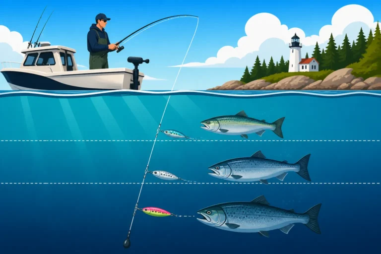
When it comes to Landlocked Salmon Fishing in Maine and Lake Trout and Togue Fishing in Maine, these cold-water species often exhibit different behaviors that dictate how you'll use your fish finder. Landlocked salmon are frequently found suspended in the mid-water column, especially during warmer months, chasing baitfish like smelt. On your fish finder, look for individual, strong arches or groups of arches at specific depths, often near thermoclines, with schools of baitfish nearby. Trolling passes are essential here, as you're covering a lot of water, and your fish finder will show you exactly what depth the fish are holding at, allowing you to adjust your downriggers or lead core lines accordingly.
Togue (lake trout) are often more bottom-oriented, especially in very deep water, but they can also suspend. When targeting them near the bottom, you'll be looking for arches or strong marks tightly associated with the lakebed. Pay close attention to deep rock piles, humps, and major drop-offs, as togue love to ambush prey from these structures. Your fish finder's zoom function (especially bottom lock) and Down Imaging will be invaluable for distinguishing these bottom-hugging fish from the actual structure. When ice fishing for togue, your flasher or traditional 2D sonar will show you the fish moving in and out of your cone angle directly beneath the hole, allowing you to actively jig for them. Understanding how to interpret these distinct patterns is critical for success with these iconic Maine game fish. Many advanced units can even help you find the optimal Best Depth for Togue on Moosehead Lake in Summer.
Locating Bass and Brook Trout
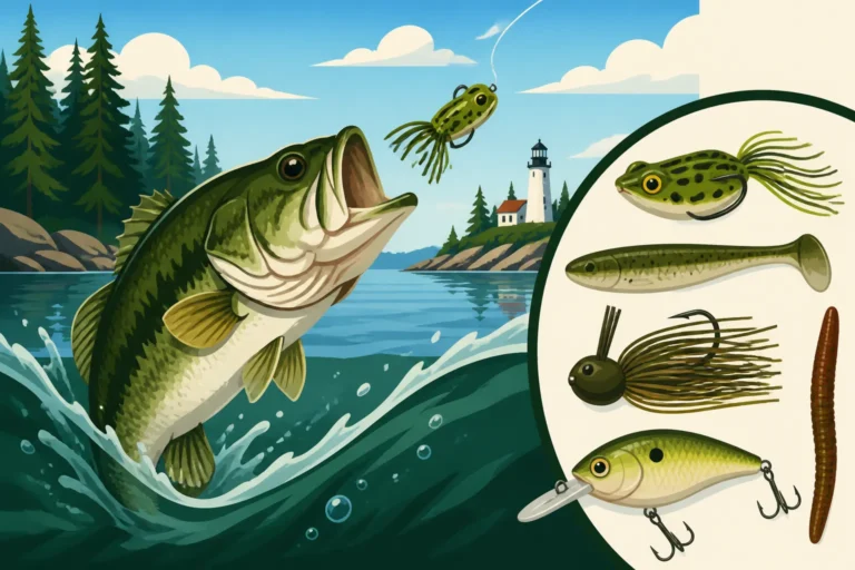
Targeting smallmouth and largemouth bass in Maine often means focusing on different structures and shallower water. Bass are generally more structure-oriented than suspended, so your fish finder becomes a powerful tool for finding those hidden holding spots. For Smallmouth Bass Fishing in Maine, you'll be looking for rocky points, humps, ledges, and transition zones where hard bottom meets soft. Side Imaging is incredibly useful here for scouting large areas of structure without driving directly over them and spooking fish. On 2D sonar, bass will often appear as strong arches directly on or very close to structure.
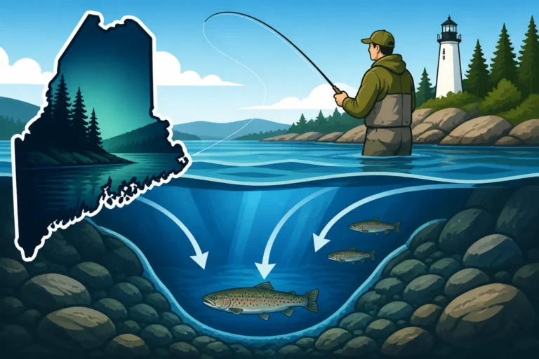
Brook Trout Fishing in Maine can be a bit more varied. In small ponds and streams, a fish finder might not be as critical, but in larger lakes where brook trout are stocked or find deep, cold-water refuges, it becomes very important. Look for brook trout near submerged wood, weed edges, or along rocky shorelines in shallower areas early and late in the season. In summer, they'll retreat to colder, deeper water, often near springs or cold-water inlets, where your fish finder can help pinpoint their location near the bottom or suspended just above it. For both bass and trout, understanding Reading Lake Structure for Maine Bass directly correlates with effectively using your fish finder.
Adjusting for Ice Fishing Conditions
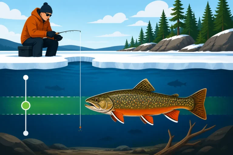
Ice fishing presents its own unique set of challenges and advantages for fish finder users. Unlike open water, your boat isn't moving, so the concept of an "arch" is different. During ice fishing, a fish finder (often a specialized flasher or a portable 2D sonar unit) is deployed directly into a hole in the ice. You're looking for real-time returns directly below your transducer, often displayed as colors indicating strength. You'll see your bait as a distinct mark, and fish will appear as they move into and out of your sonar cone. This is an active, engaging way to fish. For more details, check out our Maine Ice Fishing Techniques Guide.
For ice fishing, your fish finder helps you understand the depth, track your jig or bait, and most importantly, see fish approaching your presentation. A strong, consistent line appearing from the bottom and moving towards your bait indicates an interested fish. You can then adjust your jigging action to entice a bite. It’s also crucial for understanding bottom transitions, finding rock piles, or identifying deep holes where fish might congregate. Pay attention to battery life in the cold, and ensure your transducer is properly submerged without air bubbles for the clearest picture. Knowing How Many Lines Are Legal for Maine Ice Fishing? will also help you plan your setup, especially with multiple tip-ups and a single jigging rod over your flasher. If you're targeting specific species, understanding How to Fish for Togue Through the Ice is particularly relevant for winter anglers.
| Sonar Display Type | Best Use Cases on Maine Lakes | What to Look For | Advantages | Disadvantages |
|---|---|---|---|---|
| 2D Sonar (Traditional) | General fish finding, depth, bottom composition, suspended fish, ice fishing. | Fish arches, bottom line thickness, bait balls, thermoclines. | Versatile, good in deep water, real-time feedback for ice fishing. | Can be cluttered, harder to distinguish fish from structure sometimes. |
| Down Imaging (DI) | Detailed structure identification (rocks, timber, weeds), distinguishing fish from structure, bottom detail. | Photo-like images of objects directly below, clear contours, vertical fish. | Excellent detail, easy to interpret structure, less clutter than 2D in some cases. | Only shows directly below boat, smaller coverage area than Side Imaging. |
| Side Imaging (SI) | Scouting large areas quickly, finding offshore structure, locating fish relating to distant cover, identifying drop-offs. | Photorealistic images to the sides of the boat, structure outlines, schools of fish away from path. | Huge coverage area, finds hidden spots, great for pattern fishing. | Requires boat movement, higher power draw, learning curve for interpretation. |
| Flasher (Ice Fishing) | Real-time vertical jigging, seeing fish react to bait, precise depth in a single hole. | Colorful bands indicating depth, fish, and bait; instant feedback. | Extremely fast, excellent for vertical presentations, battery efficient in cold. | Limited to single spot, no mapping or history display. |
Disclaimer
Please remember that fishing regulations, license requirements, and local conditions can change. Always consult the most current Maine Department of Inland Fisheries and Wildlife (MDIFW) regulations before heading out on the water. This guide is for informational purposes only and should not replace official sources. Practice safe boating and ice safety, and always respect the environment.