How Far Can You Canoe the Allagash in a Week?
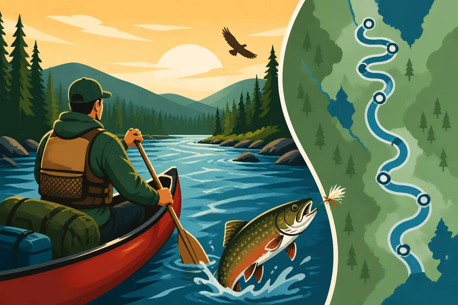
Planning a wilderness canoe trip on the legendary Allagash Wilderness Waterway (AWW) is an incredible adventure, but figuring out how much ground you can realistically cover in a week can feel like trying to paddle upstream before you even launch. Many folks dream of navigating its full length, but a week-long journey through this iconic Maine waterway requires careful consideration of its unique characteristics, your experience, and what you truly want from the trip. This guide will help you understand the variables involved and map out a realistic itinerary for your Allagash week.
Understanding the Allagash Wilderness Waterway (AWW)
The Allagash Wilderness Waterway, often simply called the "Allagash," is a magnificent, 92-mile ribbon of lakes, ponds, rivers, and streams that winds its way through the vast North Maine Woods. Managed by the Maine Department of Agriculture, Conservation and Forestry's Bureau of Parks and Lands, it’s a protected corridor designed to preserve its wilderness character, offering an unparalleled backcountry experience. When you embark on an Allagash trip, you're not just paddling; you're stepping back into a simpler time, where the rhythm of the river and the calls of the loons dictate your pace.
The Waterway's Unique Character
The Allagash isn't just one type of water; it's a diverse system that presents a variety of paddling challenges and serene moments. You'll encounter large, open lakes like Telos, Chamberlain, Eagle, Churchill, and Umsaskis, which can be absolutely stunning on a calm morning but turn into formidable, wind-swept beasts in the afternoon. Connecting these lakes are stretches of moving river, ranging from gentle currents to exciting Class I and II rapids, such as those at Chase Rapids and Allagash Falls.
Navigating these different water bodies requires adaptability. On the lakes, you'll be paddling against potential headwinds or enjoying a smooth glide with a tailwind, while on the river sections, the current will often carry you along. This constant change is part of the allure but also a key factor in how far you can travel each day. Understanding the flow, the potential for strong winds on open water, and the locations of the more challenging rapids is crucial for planning your daily mileage.
Key Access Points and Sections
The traditional starting point for the Allagash Wilderness Waterway is Telos Landing, at the southern end. From here, you typically paddle or portage into Chamberlain Lake, marking the true beginning of the downstream journey. Other common starting points, especially for shorter trips, include Chamberlain Lake or Umsaskis Lake, depending on how much time you have and which sections you wish to experience. The waterway officially ends at Allagash Village, where the Allagash River meets the St. John River.
Many paddlers opt to focus on specific sections if they don't have time for the full 92 miles. For instance, the section from Chamberlain Lake down through Churchill Lake, tackling Chase Rapids, and continuing to Umsaskis Lake, is incredibly popular for its mix of lake paddling and exciting river stretches. Or, you might choose to start further north, perhaps at Umsaskis Lake, and spend your week exploring the lower, more riverine parts of the waterway, culminating in the impressive Allagash Falls. Each section offers a unique blend of scenery and challenges, directly impacting how far you can realistically go.
Factors Influencing Your Allagash Travel Distance
The idea of paddling the "full 92 miles" in a week is alluring, but the reality of wilderness travel means you'll rarely cover ground at a consistent, leisurely pace. Several critical factors will influence your daily mileage and, ultimately, how far you can realistically travel on the Allagash in seven days. Ignoring these can lead to frustration or, worse, safety issues.
Water Levels and Current Conditions
This is arguably the most significant variable. The Allagash is a living river system, and its water levels fluctuate based on recent rainfall and seasonal runoff.
- High Water: When water levels are high, the current in the river sections is stronger, essentially giving you a free ride downstream. This means you can cover significantly more distance with less effort. Rapids like Chase Rapids become more powerful and exciting, but also require more attention and skill. High water can also mean submerged rocks are less of a concern, making navigation smoother.
- Low Water: Conversely, during periods of low water, the current slows dramatically. You'll have to paddle harder to maintain speed, and shallow sections might become more numerous, forcing you to navigate carefully or even get out and pull your canoe. This reduces your effective travel distance and increases your physical exertion. Paddling through the narrow thoroughfares between lakes, like the Thoroughfare between Chamberlain and Eagle Lake, can become a real slog in low water. Always check the Maine Bureau of Parks and Lands website or call local outfitters for up-to-date water level reports before your trip.
Wind Conditions on Open Lakes
The Allagash Wilderness Waterway is punctuated by several large lakes that can feel like inland seas on a windy day. Chamberlain Lake, Eagle Lake, and Umsaskis Lake, in particular, are notorious for kicking up significant waves when strong winds blow.
- Headwinds: Battling a strong headwind on a large lake is incredibly physically demanding and can drastically slow your progress. It might even force you to take shelter on shore and wait for the wind to die down, effectively shortening your paddling day.
- Tailwinds: A strong tailwind, on the other hand, can propel you across a lake with minimal effort, allowing you to cover significant distances quickly. However, even a tailwind can create challenging conditions with large following seas that can swamp an inexperienced paddler.
It's common for experienced paddlers to plan their lake crossings for early mornings when winds are typically calmer. Being prepared for varying wind conditions, both physically and with appropriate gear, is essential for a successful trip.
Paddling Experience and Fitness Level
Your group's collective paddling experience and physical fitness play a massive role in how many miles you can comfortably cover each day.
- Experience: Seasoned canoeists who can maintain a strong, efficient stroke and navigate rapids with confidence will naturally cover more ground than beginners. They also know how to read the water, identify the fastest current, and conserve energy.
- Fitness: Paddling, especially day after day, is a full-body workout. If your group isn't accustomed to sustained physical activity, you'll tire more quickly, leading to slower speeds and shorter days. Remember, it's not a race! The goal is to enjoy the wilderness, not exhaust yourselves. If you're planning a multi-day trip like this, you might find useful information in our guide on How to Plan a Multi-Day Fishing Trip, even if your focus isn't solely on fishing.
Trip Goals and Desired Pace
What do you want to get out of your week on the Allagash? This fundamental question directly influences your daily mileage.
- "Covering Ground" Trip: If your primary goal is to complete the entire 92 miles or a significant portion of it, you'll need to focus on maximizing paddling time, minimizing stops, and pushing for higher daily mileages. This might mean fewer opportunities for fishing, wildlife viewing, or extended breaks.
- Leisurely "Wilderness Experience" Trip: Many paddlers come to the Allagash for the serene wilderness, the opportunity to fish for brook trout, or simply to relax by the campfire. If your goal is to immerse yourself in the experience, you'll want to plan for shorter paddling days, allowing ample time for side excursions, photography, or just enjoying the quiet. Remember to consult an Allagash Wilderness Waterway Fishing Guide if angling is a priority for your group. You'll want to be aware of Maine Fish Bag Limits Guide and Maine Fishing Season Dates Guide too.
Portages and Obstacles
The Allagash has a few mandatory portages that, while not exceptionally long, do consume time and energy.
- Churchill Dam Portage: This is a significant carry, typically around 1/4 mile, where you must portage your canoes and gear around the dam.
- Allagash Falls Portage: Another essential portage, especially if you plan to continue past the falls. It's often shorter but can be steep.
Beyond these, you might encounter other obstacles like fallen trees (especially after storms) that require bushwhacking around or carefully maneuvering over. Each portage and unexpected obstruction adds time to your day and reduces your effective paddling distance. Taking these into account in your daily planning is crucial.
Realistic Weekly Itineraries for the Allagash
Given the varying factors, a "one size fits all" answer for how far you can canoe the Allagash in a week simply doesn't exist. However, we can look at common itineraries and realistic expectations for different types of trips. Remember, your average paddling speed on a wilderness trip with gear will be significantly less than a sprint on calm water. A realistic average might be 2-3 miles per hour, but that's without accounting for wind, current changes, or scenic stops.
The Full 92 Miles: Is it Feasible in a Week?
Yes, completing the entire 92 miles from Telos Landing to Allagash Village in seven days is possible for experienced, fit paddlers who are dedicated to covering ground. However, it will be a challenging, physically demanding trip with long paddling days (15-20 miles per day) and minimal time for relaxation or side excursions.
What this entails:
- Early Starts and Late Finishes: You'll be on the water for many hours each day, often starting at dawn and paddling well into the afternoon.
- Focus on Mileage: Your primary goal will be to cover distance, meaning less time for fishing, hiking, or exploring historical logging camps. You might still enjoy some Allagash River Brook Trout Fishing in Maine but it won't be the focus.
- Favorable Conditions: This itinerary is far more enjoyable and realistic with good water levels (strong current) and minimal headwinds on the lakes. If you encounter strong headwinds or low water, completing the full distance in a week could become a real grind or even require extending your trip.
- Minimal Delays: Any significant delays due to weather, gear issues, or unexpected challenges will quickly eat into your schedule.
For many, especially those who want to truly soak in the wilderness experience, trying to do the full 92 miles in a week can feel rushed.
Common Weekly Sections for a More Enjoyable Pace
Most paddlers opt for a more moderate pace, choosing to focus on a 50-70 mile section of the waterway over a week, which allows for a much richer experience. This balance of paddling and leisure is often what makes an Allagash trip so memorable.
1. Telos/Chamberlain to Round Pond/Umsaskis Lake (Approx. 50-60 miles)
- Starting Point: Telos Landing (requiring a short carry into Chamberlain Lake) or Chamberlain Lake.
- Highlights: Paddling the large, historic Chamberlain Lake, the thrilling Chase Rapids (Class I-II) below Churchill Dam, and navigating through Eagle Lake, including a view of the famous abandoned locomotives. You'll then continue through the thoroughfare into Umsaskis Lake, a beautiful, sprawling lake.
- Pace: This section typically involves 8-12 miles of paddling per day, offering ample time for fishing, wildlife viewing, and enjoying riverside campsites. It's an excellent option for groups with mixed experience levels.
2. Umsaskis Lake to Allagash Village (Approx. 40-50 miles)
- Starting Point: Umsaskis Lake (often accessed by a float plane or vehicle shuttle to the top of the lake).
- Highlights: Primarily river paddling, with faster currents, more frequent twists and turns, and a feeling of deeper wilderness immersion. The journey culminates with the impressive Allagash Falls portage and the final paddle to Allagash Village.
- Pace: Similar to the above, 8-12 miles per day allows for a relaxed pace. This section is generally less prone to severe wind delays on large lakes, making daily mileage more predictable.
Example Daily Itinerary (Umsaskis to Allagash Village over 7 days, approx. 45 miles)
This example offers a more relaxed pace, ideal for those who want to fish, explore, and truly unwind.
| Day | Section | Est. Miles | Highlights / Activities |
|---|---|---|---|
| Day 1 | Arrive/Launch at Umsaskis Lake | 0-5 | Travel to launch point, set up camp, organize gear. Short paddle to a nearby campsite on Umsaskis Lake. Enjoy the tranquility, possibly an evening paddle or shore fishing. |
| Day 2 | Umsaskis Lake to Long Lake | 7-9 | Paddle the remainder of Umsaskis Lake, navigating into Long Lake. Watch for wildlife along the shores. Fishing for brook trout in the connecting thoroughfares. |
| Day 3 | Long Lake to Round Pond | 6-8 | Continue through Long Lake, entering the narrower river sections. Look for signs of moose. Set up camp on Round Pond. More fishing opportunities. |
| Day 4 | Round Pond to Musquacook Stream | 7-9 | Gentle river paddling through beautiful forest scenery. Explore Musquacook Stream for smaller brook trout. Enjoy a leisurely lunch on a sandbar. |
| Day 5 | Musquacook Stream to Big Brook | 6-8 | Continue downstream, enjoying the consistent current. Keep an eye out for bald eagles. Camp near Big Brook. Prepare for the falls. |
| Day 6 | Big Brook to Allagash Falls (portage) | 5-7 | Paddle to Allagash Falls. Take your time with the portage around the falls. Enjoy the powerful sight of the falls. Camp just below the falls. |
| Day 7 | Allagash Falls to Allagash Village | 5-7 | Final paddle to Allagash Village. Reflect on the journey, take out canoes, and prepare for departure. |
This itinerary totals around 40-50 miles, leaving plenty of room for rest, fishing, photography, and simply absorbing the wilderness. For those interested in deeper fishing insights for specific species, guides like Best Brook Trout Water in the Allagash Wilderness Waterway can be invaluable resources.
Essential Planning for a Successful Allagash Adventure
A week on the Allagash isn't just about how far you paddle; it's about the entire experience. Careful planning is paramount to ensuring a safe, enjoyable, and memorable trip. Neglecting any of these elements can quickly turn an adventure into a nightmare.
Permits and Reservations
The Allagash Wilderness Waterway is a managed public resource, and strict regulations are in place to preserve its integrity and ensure a quality experience for all visitors.
- Permits are Mandatory: You must register and pay fees to use the waterway. This involves obtaining a campsite reservation and an entry permit. These are often booked well in advance, especially for prime summer dates. Don't show up expecting to just launch; wardens patrol the waterway, and fines for non-compliance are hefty.
- North Maine Woods Gate Fees: Access to the Allagash typically involves traveling through the privately owned North Maine Woods, which charges gate fees. Factor these costs into your budget.
- Research Current Regulations: Beyond permits, familiarize yourself with all the current rules, including fire restrictions, waste disposal guidelines, and fishing regulations. Our detailed guide on Fishing Permits Needed for the Allagash Wilderness Waterway has all the information you need, and a general understanding of Maine Fishing Regulations Explained is always helpful.
Gear and Provisions: Prepare for the Unexpected
Packing properly for a week in the Maine wilderness is critical. You'll be self-sufficient for the duration of your trip, so what you bring (or don't bring) matters.
- Canoe and Paddles: Ensure your canoe is in excellent condition and appropriate for wilderness tripping. Bring spare paddles!
- PFDs (Life Jackets): Absolutely mandatory and should be worn at all times on the water.
- Shelter: Tents, tarps, and sleeping bags suitable for potentially cold, wet Maine nights, even in summer.
- Cooking Gear: Camp stove, fuel, pots, utensils, and a reliable water filter or purification tablets.
- Food: Plan every meal. Pack non-perishable, high-energy foods. Bear-proof food storage is essential.
- Navigation: Waterproof maps (the official AWW map is excellent), compass, and a GPS device (with spare batteries) are non-negotiable. Cell service is virtually non-existent.
- First Aid Kit: A comprehensive kit capable of handling minor injuries and emergencies.
- Clothing: Layers are key, even in summer. Think quick-drying synthetics, rain gear, and warm options for evenings. You might not be ice fishing, but knowing What to Wear Ice Fishing in Maine Winters for layering principles can be a good reference.
- Fishing Gear: If you plan to fish, bring appropriate rods, reels, tackle, and a valid Maine Fishing License Guide. Remember to adhere to Maine Fish Bag Limits Guide.
Shuttle Services and Logistics
The Allagash is a linear trip, meaning your starting point is far from your ending point. This creates a logistical challenge for vehicle retrieval.
- Outfitters and Shuttle Services: Most people hire a professional outfitter or shuttle service to move their vehicle from their put-in point to their take-out point (Allagash Village). This service is invaluable, albeit an added cost, as it allows you to finish your trip knowing your vehicle awaits.
- Planning Ahead: Book these services well in advance, especially during peak season. Coordinate drop-off and pick-up times carefully.
- Contingency Plans: What if your shuttle is late? What if you finish a day early/late? Have a clear plan and communication strategy with your shuttle provider.
Safety Considerations and Respecting the Wilderness
Safety should always be your top priority. The Allagash is a remote wilderness, and help is often hours away.
- Weather Awareness: Maine weather can change rapidly. Be prepared for rain, wind, and even sudden temperature drops. Learn to read the sky and know when to seek shelter.
- Rapids Navigation: If your route includes rapids like Chase Rapids, ensure everyone in your party has some experience or guidance. Consider a Hiring a Maine Fishing Guide or Maine Canoe Trip Fishing Guides service if you're unsure about tackling rapids or navigating the wilderness independently. These professionals are intimately familiar with the waterway and its challenges.
- Wildlife Encounters: You'll be in bear and moose country. Know how to store food properly, how to react to animal encounters, and never approach wildlife.
- Leave No Trace: The Allagash's pristine nature depends on every visitor adhering to Leave No Trace principles. Pack out everything you pack in, properly dispose of human waste, minimize campfire impacts, and leave campsites cleaner than you found them.
- Emergency Communication: While cell service is rare, consider carrying a satellite communication device (like a Garmin inReach or a SPOT device) for emergencies. This can literally be a lifesaver.
While the Allagash Wilderness Waterway isn't typically where you'd utilize services like FishingBooker, which is generally for booking guided fishing charters in more accessible coastal or lake destinations, the emphasis on preparation and professional guidance for any significant fishing or outdoor adventure remains consistent. For example, if you were planning a coastal striped bass trip, FishingBooker could help you find a captain, but for the remote Allagash, your focus is squarely on self-reliance or a specialized Maine guide service. The principle, however, is the same: arm yourself with knowledge and the right support for the specific challenge at hand.
Disclaimer
Please note that fishing regulations, waterway rules, and conditions on the Allagash Wilderness Waterway can change. Always consult the official Maine Department of Inland Fisheries and Wildlife (MDIFW) and the Maine Bureau of Parks and Lands websites for the most current information before planning your trip. This guide is for informational purposes only and should not replace official sources or professional guidance.