How to Find Drop-Offs on a New Lake
There’s a unique blend of excitement and apprehension that washes over every angler when they pull up to a brand-new lake for the very first time. You’ve got your gear, your hopes are high, but where do you even start? It can feel like looking for a needle in a haystack, especially on a vast, unfamiliar body of water. The secret to unlocking a new lake's potential often lies in finding its hidden contours, and nothing is more crucial than locating those elusive drop-offs. This guide will walk you through exactly how to find those fish-holding structures, turning that initial apprehension into confident exploration.
Why Drop-Offs are an Angler's Best Friend
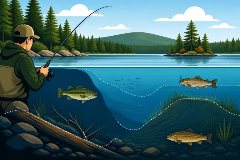
Before we dive into how to find them, let's take a moment to really understand why drop-offs are so vital for any angler, whether you're chasing brook trout in a remote pond or trying to find landlocked salmon on a massive lake like Sebago. Imagine a vast, flat underwater plain. While fish might occasionally cruise here, it lacks the dynamic environment that truly attracts and holds them. Now, picture a steep incline, a sudden change in depth where the bottom drops away quickly from a shallow flat into deeper water. This is a drop-off, and it's a bustling underwater highway and diner for fish.
The Fish Magnet Effect of Structure
Drop-offs are essentially natural structure, and fish are drawn to structure like moths to a flame. Think about it from a fish's perspective: these areas offer the best of both worlds. The shallower, warmer water on top of the drop-off can be teeming with baitfish, insects, and other food sources, particularly during certain times of the day or year. However, if danger lurks—a predatory bird, a bigger fish, or even a sudden change in light—that deeper water is just a fin-flick away, offering a quick escape and security.
This proximity to both food and safety makes drop-offs prime real estate for a wide variety of fish. You'll often find baitfish congregating along these edges, sifting through debris or feeding on aquatic insects. Larger predatory fish, like smallmouth bass or lake trout (or as we call them here in Maine, togue), will patrol these edges, ambushing unsuspecting prey as they move between the shallows and the depths. Understanding this fundamental principle is the first step to confidently approaching any new body of water.
Thermoclines and Optimal Temperatures
Beyond just providing cover and food lanes, drop-offs often play a critical role in temperature regulation for fish, especially during the warmer summer months. Many Maine lakes, particularly the deeper ones, develop a phenomenon called a "thermocline." This is a distinct layer in the water column where the temperature changes rapidly. Above the thermocline, the water is warmer; below it, it's significantly colder. Many game fish, especially cold-water species like salmon and trout, have a preferred temperature range.
During summer, when surface waters heat up, these fish will often retreat to the cooler, deeper waters below the thermocline. However, they still need to feed. This is where drop-offs become absolutely crucial. A drop-off allows these fish to move vertically through the water column, accessing their preferred cool temperatures while still having easy access to the shallower, warmer water where baitfish and insect hatches might be more active. You might find fish suspended right along the thermocline, especially where it intersects a drop-off, as this offers the perfect balance of comfort and feeding opportunities. Learning to read water temperature for Maine trout can give you a significant edge in these situations.
Reading the Water: Visual Clues and Topographic Maps
You don't always need high-tech gadgets to start identifying potential drop-offs. Sometimes, the lake itself will give you plenty of clues, if you know what to look for. Combine these visual observations with some good old-fashioned map reading, and you’ll be off to a fantastic start.
Interpreting Shoreline Features
One of the oldest tricks in the book is to "read the bank." The contours of the shoreline above water often mirror the contours of the lake bottom below. It's not a perfect science, but it’s a remarkably consistent indicator.
- Steep Banks and Bluffs: If you see a steep bank, a rocky cliff, or a pronounced bluff on the shoreline, it's highly likely that the bottom drops off sharply right there. This is especially true in many of Maine's glacial lakes, which are often carved out with dramatic underwater topography. Picture the rocky shores of Moosehead Lake or Rangeley Lakes – where the land rises sharply, the water often deepens quickly. These are prime areas to investigate.
- Gradual Slopes and Beaches: Conversely, if the shoreline slopes gently into the water, forming a beach or a marshy area, chances are the bottom extends out in a similarly gradual, shallow slope. While these shallow flats can be great for bass in spring or fall, they're less likely to hold the dramatic drop-offs we're seeking.
- Points and Coves: Points that jut out into the lake are almost always worth exploring. As the point extends underwater, it often creates natural funnels and breaks in current, and its sides will usually be steep drop-offs. Coves, particularly the deeper ends, can also feature drop-offs where their sides plunge into the main lake basin. Look for irregularities in the shoreline rather than long, straight stretches.
Utilizing Topographic Maps and Apps
Once you've made your visual observations, it's time to confirm and expand your understanding with a topographic map. These are invaluable tools for understanding underwater structure.
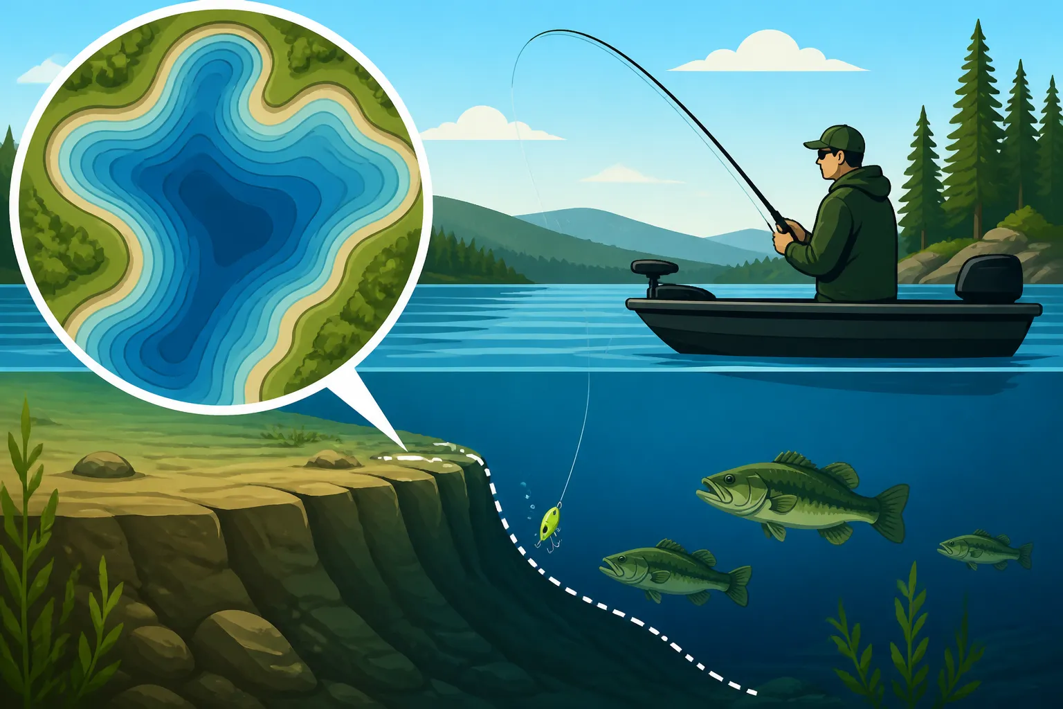
- Understanding Contour Lines: On a fishing topo map (sometimes called a bathymetric map), you'll see contour lines, much like on a land map. These lines connect points of equal depth. When these lines are far apart, it indicates a gradual slope. When they are very close together, that's your drop-off! The closer the lines, the steeper the drop. You can usually find excellent waterproof maps for specific Maine lakes on Amazon, or through local bait and tackle shops.
- Identifying Key Features: Topo maps will clearly mark depths, channels, humps, points, and sudden changes in depth. Look for areas where a shallow flat (wide-spaced contour lines) suddenly meets tightly packed lines, indicating a significant drop. These maps are fantastic for planning your approach to a new lake, allowing you to identify several promising areas before you even launch your boat. Many modern anglers use digital apps on their phones or tablets that offer interactive topographic maps, often with more detail and customization options. These apps can even integrate with GPS, showing your exact position on the map, which is incredibly useful for navigating unfamiliar waters and marking potential hot spots. Before your trip, download or purchase maps for the specific body of water you'll be exploring. These will be crucial for understanding How to Fish a New Lake You Have Never Fished
- Cross-Referencing: Always cross-reference what you see on the map with your visual observations. Does a steep bank on shore align with tightly packed contour lines on the map? Perfect! That's a strong indicator of a productive drop-off. Over time, you’ll develop an instinct for predicting underwater topography based on what you see above the surface.
Getting Technical: Using Sonar and Other Tools
While visual cues and maps give you a great starting point, modern sonar technology takes the guesswork out of finding drop-offs, allowing you to pinpoint them with incredible accuracy.
Decoding Your Fish Finder
A good fish finder is arguably the most valuable tool for locating underwater structure on a new lake. It’s your window into the underwater world.
- Basic Sonar: Traditional 2D sonar displays echoes as arches (fish) or lines (bottom). A drop-off will appear as a sudden, sharp change in the bottom line on your screen. As you move from shallow to deep, the bottom line will abruptly plunge downwards. Pay attention to how quickly the depth reading changes. A rapid increase in depth over a short distance indicates a steep drop.
- Down Imaging: Many modern fish finders come with down imaging or similar technologies (like Lowrance's StructureScan or Humminbird's MEGA Down Imaging). These modes provide a picture-like view of what's directly beneath your boat, making it much easier to interpret structure. On a down imaging screen, a drop-off will look like a clear, sudden cliff face or slope. You'll literally see the bottom falling away. This visual clarity is a game-changer for identifying even subtle changes in depth. When you're learning Best Sonar Settings for Finding Fish, focusing on the clarity of bottom contours is key.
- Side Imaging/SideScan: If your unit has side imaging, you've got an even more powerful tool. Side imaging scans out to the sides of your boat, allowing you to cover a much wider area. A drop-off will show up as a dark line or shadow on the edge of the shallower bottom, indicating the sudden change to deeper water. You can even see the fish that are holding on these edges, giving you incredible insight into their behavior. This is particularly useful for covering large areas quickly and finding submerged structure you might otherwise miss.
- Waypoint Marking: As you identify promising drop-offs on your sonar, always mark them with a waypoint on your GPS. This allows you to return to that exact spot later, whether to fish it or to explore it further. Many anglers invest in waterproof phone cases or dedicated marine GPS units, which you can find on Amazon, to ensure their mapping and sonar data is always at hand.
Setting Up and Using Your Unit Effectively
Just having a fish finder isn't enough; you need to know how to set it up and use it for optimal results.
- Transducer Placement: Ensure your transducer is properly mounted and sending a clear signal. If it's too high, it might lose contact with the bottom at speed. If it's in turbulent water, you might get a lot of clutter.
- Sensitivity and Gain: Adjust your sensitivity or gain settings. Too low, and you might miss subtle details or even fish. Too high, and you'll get too much clutter. A good starting point is usually around 70-80% and then adjust as needed based on water depth and clarity. You want to see a clear, defined bottom line.
- Scrolling Speed: Experiment with your scrolling speed. A faster scroll gives you a more real-time view, but can make features appear compressed. A slower scroll stretches out the display, making details easier to discern. For identifying drop-offs, a medium to faster scroll is often beneficial so you can see the rapid change in depth as it happens.
- Zoom Function: Don't forget your zoom! Once you identify a potential drop-off, zoom in on that area of the screen to get a more detailed view of its exact contours and any fish holding nearby. This can help you understand Reading Lake Structure for Bass and Trout with precision.
The Low-Tech Approach: Manual Sounding
Even with all the modern technology, sometimes the simplest methods are still effective, especially if you're fishing from a canoe, kayak, or a boat without advanced electronics.
- Jigging and Drifting: One excellent way to "feel" for drop-offs is by drifting across likely areas with a heavy jig or a weight tied to your line. Let the weight hit bottom, then lift and drop it as you drift. You'll feel the bottom contour change. When your weight suddenly drops much further than expected, you've found a drop-off! You can also use this technique by slowly trolling. This is a very tactile way to learn the lake's contours.
- Weighted Marker Buoys: Carry a few weighted marker buoys. When your sonar or manual sounding indicates a drop-off, immediately drop a buoy to mark the spot. This gives you a visual reference point, allowing you to make repeated casts or passes over the productive area. These buoys are inexpensive and incredibly useful, acting as your temporary GPS when you're exploring.
On-the-Water Exploration and Fine-Tuning
Finding a drop-off is one thing; effectively fishing it is another. It takes some on-the-water technique and an understanding of how fish relate to these structures.
The Art of Drifting and Trolling Edges
Once you’ve identified a promising drop-off, either visually, with maps, or with sonar, the next step is to explore it systematically. Don’t just make a few random casts and move on.
- Controlled Drifts: If conditions allow (light wind, manageable current), try a controlled drift along the length of the drop-off. Use a drift sock or a trolling motor to slow your boat down and keep it parallel to the contour. As you drift, keep a close eye on your sonar for any fish or subtle changes in the bottom. Cast parallel to the drop, allowing your lure or bait to sink down the face of the break. This presents your offering naturally to fish holding at various depths along the slope.
- Systematic Trolling: Trolling is an incredibly effective way to cover long stretches of a drop-off, especially for species like salmon and togue. Set your lures to run at different depths, mimicking baitfish near the bottom or suspended in the water column. Troll back and forth along the edge, sometimes slightly over the shallow flat, sometimes a little deeper. Pay attention to where you get bites, as this will help you pinpoint the precise depth and location where fish are holding. This is also how many anglers fine-tune their Trolling Techniques for Maine Lakes and discover the right Trolling Depths for Landlocked Salmon.
- Fan Casting from Anchor: If you find a very specific, small drop-off or a section that looks particularly good, anchor your boat strategically. Position yourself so you can fan-cast across the entire length and depth of the drop-off. Experiment with different lures and retrieval speeds. This allows you to thoroughly work a concentrated area.
Understanding Fish Movement Along Drop-Offs
Fish don't just sit idly on a drop-off; they use it as a pathway and a hunting ground. Understanding their movement patterns will increase your success.
- Feeding Lanes: Think of drop-offs as feeding lanes. Baitfish will often school up along the shallower edge, and predatory fish will patrol the deeper side, darting up to ambush. Casting your lure from the shallow side down into the deeper water, or from the deep side up into the shallows, can trigger strikes.
- Transition Zones: Pay close attention to where the drop-off meets other features, like submerged weed lines, rock piles, or points. These transition zones often concentrate fish even further, as they offer additional cover and ambush points. A subtle change in bottom composition, from mud to rock, along a drop-off can be a hotspot.
- Time of Day and Season: Fish activity on drop-offs can change dramatically with the time of day and season. In the early morning or late evening, fish might move shallower onto the flats adjacent to the drop-off to feed. During bright midday sun or in the heat of summer, they might retreat to the deeper, cooler water along the face of the drop or even suspend directly over the deep water. In spring, when the ice just goes out, fish will be actively feeding closer to the surface near drop-offs. In the fall, as waters cool, they might be scattered but still using those deep edges. Your strategy needs to adapt to these changes.
Making It Your Own: Creating a Mental Map
Every time you explore a new lake, you're building a mental map of its underwater world. Over time, you'll start to recognize patterns and develop an instinct for where fish are likely to be.
- Detailed Notes: Don't rely solely on your memory or digital waypoints. Consider keeping a fishing journal. Jot down notes about the drop-offs you find: depth, bottom composition (rock, sand, mud), presence of cover (weeds, timber), and any fish you caught. This detailed record will be invaluable on future trips and help you refine your understanding of that specific lake.
- Patience and Persistence: Finding drop-offs, especially on a large, complex new lake, takes time and effort. Don't get discouraged if you don't find fish on the first few spots. Keep exploring, keep reading your sonar, and keep trying different techniques. The reward of discovering a productive drop-off and catching fish from it is well worth the effort. Maine offers incredible fishing, but it often rewards those who are persistent in their exploration.
Learning to find drop-offs on a new lake is one of the most fundamental and rewarding skills an angler can develop. It transforms a daunting unknown into an exciting puzzle waiting to be solved, and it will put you on fish consistently, no matter where your Maine fishing adventures take you.
| Method of Finding Drop-Offs | Pros | Cons | Best For |
|---|---|---|---|
| Visual Cues | Free, no equipment needed, quick initial assessment | Limited to shoreline features, can be misleading, not precise | First reconnaissance, quick mental mapping, small ponds |
| Topographic Maps/Apps | Detailed depth contours, pre-trip planning, precise location of features | Requires purchase/download, doesn't show real-time changes, static | Pre-trip planning, understanding overall lake structure, large lakes |
| 2D Sonar | Real-time depth changes, shows fish arches, relatively affordable | Requires interpretation, can be cluttered, less detailed bottom imagery | General depth finding, identifying fish presence |
| Down Imaging Sonar | Picture-like view of bottom, clear structure identification | More expensive, still only shows directly beneath boat | Detailed bottom analysis, discerning structure type (rocks, timber) |
| Side Imaging Sonar | Covers wide area, finds structure far from boat, highly detailed | Most expensive, steepest learning curve, advanced interpretation | Efficiently scanning large areas, finding hidden structure |
| Manual Sounding/Jigging | Free, highly tactile, good for small boats/kayaks, builds "feel" for bottom | Slow, labor-intensive, less precise, best in calm conditions | Kayak/canoe fishing, no-tech approach, beginners, small areas |
Disclaimer
This article is for general informational purposes only and does not constitute professional advice. Laws, prices and regulations vary by location and change over time. Consult a qualified professional for guidance on your specific situation.